An adapted EOV for mosaic landscapes
by Thorsten Arnold
But when I consider that the nobler animals have been exterminated here -the cougar, panther, lynx, wolverine, wolf, bear, moose, deer, the beaver,the turkey, etc., etc. – I cannot but feel as if I lived in a tamed, and as it were, emasculated country… I listen to a concert in which so many parts are wanting… for instance, thinking that I have here the entire poem, and then, to my chagrin, I hear that it is but an imperfect copy that I possess and have read, that my ancestors have torn out many of the first leaves and grandest passages…
– Henry David Thoreau, Journal, 1856
I recently conducted a feasibility study for EFAO about establishing Ecological Outcome Verification (EOV) in larger parts of Ontario. EOV is a monitoring method for holistic land management – or really, a monitoring method for any land management. A recurring challenge posed itself: What are we actually managing “toward”? What type of landscape do “we” envision in our part of this world? Landscape management has a strong normative aspect – it became clear to me that “we” can only take strategic steps toward landscape regeneration once land managers agree on a broad management direction. And I also learned that Ontario’s landscape is fundamentally different than the grasslands for which EOV was developed. So how can we bring the great opportunities of EOV to Ontario’s ecoregion context?
When exploring what type of landscape we should be aiming to regenerate in southwestern Ontario, my starting point is the past. Around 250 years ago, the region where I live was a dense deciduous forest dominated by large trees, interspersed with wetlands. The dominating trees were maples, white pines, elms, ashes, black cherries, cedars, spruces… varieties that we know from our forests today. Looking back further into the past, prior to times of first contact, settlers would have found a different landscape though: one managed by the Indigenous peoples of this region. The dense forest described above regrew after the diseases that settlers brought with them killed more than 90% of the Indigenous population of the area – ten waves of deadly epidemics within only 50 years, a suffering that we cannot imagine even during the COVID pandemic. The collapse of Indigenous cultures also ended millennia of Indigenous land management. The closed-canopy forests that many consider Ontario’s “wilderness” really reflects only a blip in natural history – a short “rewilding” period between Indigenous land management and Western settlement.
John Riley’s book The Once and Future Great Lakes Country gives the best ecological history of this region that I am aware of. It is based on the written accounts of the earliest explorers who witnessed quite different landscapes in the temperate regions around the Great Leaks. The stretch that we now call “Lake Erie toward Toronto” was dominated by Savannah-type pastureland trees – giant oaks, chestnuts, butter and hickory nuts with lots of fruit and berries, and large open grasslands in between. Further north, the Savannah morphed into open woodlands that still offered plenty of grazing grounds, interspersed with wetland bush and patches of dense, old-growth forest. Using the language of modern ecology, this landscape was a mosaic of successions. Some areas were young after wildfire disturbance, others were in later succession stages as ecosystems recovered, and there were patches of old “climax” close-canopy forest.
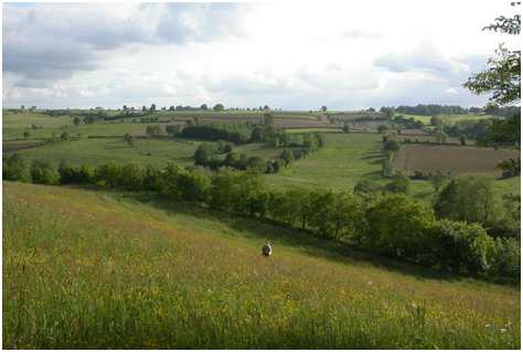
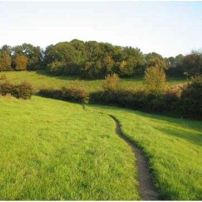
Photo credit: Gilles San Martin.
“Mosaic landscapes” are characterized by transitioning ecosystem stages. Over time, species communities of plants and animals are evolving everywhere towards their climax system. Over space, landscapes transition from one succession stage to another, with frequent changes in vegetation height, openness and sun penetration. Each stage offers different feeding and hiding spots and habitat. This spatial and temporal mosaic of succession stages allows for a habitat and species diversity that today, we can hardly imagine. Life has most vigor along gradients and edges – and mosaics create more edges than any “climax” landscape form. At least in the context of our temperate Great Lakes Country.
Mosaic landscapes reflect an equilibrium of permanent change. Each community continuously matures toward a higher succession stage: bare soil is quickly covered with early succession plants that we call “weeds” – fast-growing annuals that put most of their efforts into seed production. Perennial “weeds” follow, as do grasses and shrubs. First trees emerge – usually fast-growing, shade-intolerant species like aspens, crab apples, and birches. Later come ashes and cedars, and then the slower-growing shade-tolerant species that characterize “climax” forests: sugar maples, beeches and hemlocks, which wait for gaps in the canopy and quickly fill in until they dominate a forest. Without disturbances, succession would stop right there – there cannot be mosaics without disturbance! Disturbances may come from large trees falling over, landslides and flooding, heavy storms and wildfires, mammoths that knock over trees, human slash-and-burn agriculture, or modern logging activity. In a mosaic landscape, there is balance between community succession and disturbances events, in a way that creates a transient equilibrium. A bit like a street market where vendors change while the market maintains its bustling and colourful character. We want to manage for this bustling, for this colourfulness.
In many parts of the temperate world, mosaic landscapes used to dominate. Studies report mosaics in Japan, New England, Nova Scotia, and Indigenous Australia. In central Europe, government policy once promoted orchard meadow landscapes as bulwark against marauding armies, in order to build food systems resilience. As a side effect, these diversified landscapes also became Europe’s biodiversity hotspot – a rare beneficial outcome of Western landscape-scale government interventions! Worldwide, land managed by Indigenous peoples still protects approximately 85% of the world’s biodiversity, even though they make up less than 5% of the world’s population. Much of this is attributed to long-term and widespread relationships with fire, and its use for managing landscapes as mosaics.
Climate change gives mosaic landscapes a new urgency. Foresters now identify European-style forest management in North America – homogenous stands of same-age trees – as one of the root causes of the severe, large, and destructive wildfires that have become common in recent years. As ecoregions shift with global warming, species also need to adapt and/or migrate. Birds and other animals that transport seeds over long distances play a key role here; they need migration corridors.
In this context, advocates promote the revival of the Indigenous land management practices. These include the tradition of cultural burns (e.g. The Narwhal, Sept 2020), a context-based practice that promoted the burning of small areas for multiple benefits, in awareness of the succession dynamics of ecosystems. Indigenous knowledge keepers used low-intensity burns for several purposes simultaneously. One, burns reduced the load of dead biomass on the ground. Two, In spring burns, ashes removed dead grasses and blackened the soil, leading to an earlier flash of vegetation that attracted grazing animals for hunting. Three, burns kept landscapes open without damaging old trees, fostered diversity of habitat and biological communities, and prevented the disastrous forest fires we are experiencing today. In parts of Canada, a return to cultural burning practices may be our only option, as the climate crisis fuels wildfires at unprecedented frequency and scale – which would inevitably bring back mosaic landscapes.
When managing for landscape resilience on an ecological farm, I believe that the concept of landscape mosaics can provide a guiding compass for our decision making. We can assume that a more diverse mosaic that is rich in edges or “ecotones” (where one biological community transitions into another) will come along with increased biodiversity and overall resilience. The concept reconnects us to traditional Indigenous land use practices, without attempting to force us “back in time:” lost ecosystems cannot be restored as new species have invaded and climate is shifting. But we can revitalize the fundamental character of biodiverse mosaic landscapes in ways that assist the shifting of ecoregions in our warming climate, regenerate biodiversity, and foster societal resilience.
Photo credit: Krzysztof Golik
Mosaic landscapes challenge Savory Institute’s EOV methodology. The EOV was originally developed for homogenous grassland landscapes with shifting biological community mosaics, so ranchers mainly focused their attention to these communities within their fields. In temperate regions with our forest ecology, ecological health needs to be examined from the perspective of the entire landscape. This extends beyond the pasture, which Savory’s EOV would be examining. Instead, an EOV that is adapted for mosaic landscapes would have to take into account landscape connectivity features such as hedgerows and windbreaks, streams and rivers, bushes and woodlands, and wetlands. It would look at the age and species composition of the hedgerow that surrounds a field. It would look at habitat provided by surrounding features – nesting opportunities, food sources and hiding spots during disruptive events.
Where are we going next? Most aspects of Savory’s EOV can be maintained for farm health monitoring around soil health, water cycle impacts, and mineral cycling. Then, well established methods could complement Savory’s original EOV to address ecological health from a landscape mosaic perspective: farm habitat health assessment, hedgerow health assessment, and pollinator habitat methods are either well-established in Ontario, or may be borrowed from similar jurisdictions (Ireland, the UK). Indicator species – maybe birds, amphibians or snakes? – can indicate the complexity of biological communities. And fortunately, we farmers don’t need a perfect methodology – we need one that helps us manage better and that is easy. Personally, I believe that monitoring the abundance of toads in a field, the age composition and diversity of trees and bushes in nearby hedgerows/windbreaks, access to water sources, and the availability of nesting & feeding grounds for a diversity of birds and insects will take us a long way towards an “EOV for mosaic landscapes”.
Savory’s original EOV is developed for mosaic plant communities within relatively homogenous grassland landscapes. Translating this method into Ontario’s context first requires that we explicitly define a desirable landscape that we want to manage for – I have argued for the concept of “mosaic landscape.” Secondly, we need to complement Savory’s EOV methodology with assessment methods that characterize the desirability of our landscape. This requires some research, as well as hands-on trial and error.
I believe that ecological outcome verification is amongst the most powerful methods to promote regenerative agriculture. We urgently need this method to stay true to our regenerative values, as our niche sector is facing all sorts of co-options: Ministries prefer promoting specific management practices or technologies; corporations water down “regeneration”, and even we ourselves cannot legitimately claim to be “regenerative” without proving regenerative outcomes. A location-adapted EOV could level the ground.
As part of the farmer community, I hope that we can come together and work on this adapted EOV for mosaic landscapes. I believe that EFAO is well positioned to support such effort – as networking organization, on-farm research platform, and through education.
- Forman, RT. Land Mosaics: The ecology of landscapes and regions (1995). The Ecological Design and Planning Reader; IslandPress: Washington, DC, USA. 2014 Dec 22:217-34.
- Oehler JD, Covell DF, Capel S, Long B, editors. Managing grasslands, shrublands, and young forest habitats for wildlife: a guide for the Northeast. Northeast Upland Habitat Technical Committee, Massachusetts Division of Fisheries & Wildlife; 2006.
- Stewart B, Neilly P. A procedural guide for ecological landscape analysis. Nova Scotia: Truro, NS, Canada. 2008 Feb 29.
- Brook BW, Bowman DM. Postcards from the past: charting the landscape-scale conversion of tropical Australian savanna to closed forest during the 20th century. Landscape Ecology. 2006 Nov;21(8):1253-66.
- Rotherham, I. D. (2008). Orchards and groves: Their history, ecology, culture and archaeology. In I. D. Rotherham I.D. (Ed.), Landscape archaeology and ecology (Volume 7). Sheffield, U.K.: Wildtrack Publishing.
- Hoffman KM, Davis EL, Wickham SB, Schang K, Johnson A, Larking T, Lauriault PN, Le NQ, Swerdfager E, Trant AJ. Conservation of Earth’s biodiversity is embedded in Indigenous fire stewardship. Proceedings of the National Academy of Sciences. 2021 Aug 10;118(32).
- Gömöry D, Krajmerová D, Hrivnák M, Longauer R. (2020). Assisted migration vs. close-to-nature forestry: what are the prospects for tree populations under climate change?. Lesnicky Casopis. 2020;66(2):63-70.